El Niño is a hot topic: What does it mean for people and our ocean?
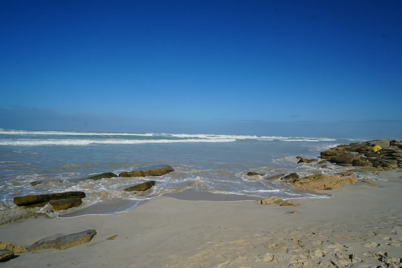
In August 2026, the South African Weather Service (SAWS) warned that the developing El Niño could be among the strongest on record. With global temperatures already reaching unprecedented highs, what could this powerful climate phenomenon mean for our ocean, marine ecosystems, and communities around the world?
What is El Niño?
El Niño is often perceived as a standalone event, but it is actually the warm phase of a naturally occurring climate pattern called the El Niño-Southern Oscillation (ENSO). One of Earth’s most important sources of year-to-year climate variability, ENSO comprises changes in both the ocean and atmosphere across the tropical Pacific.
ENSO occurs in irregular cycles of two to seven years, and moves between three phases: El Niño, La Niña, and a neutral state. El Niño temporarily raises the global average temperature, while La Niña has a cooling influence. These natural fluctuations occur alongside the longer-term warming caused by human-induced climate change.
As Earth’s largest ocean, the Pacific Ocean stores and redistributes vast amounts of the sun’s heat. The interactions between its surface waters and the atmosphere have a foundational influence on the global climate.
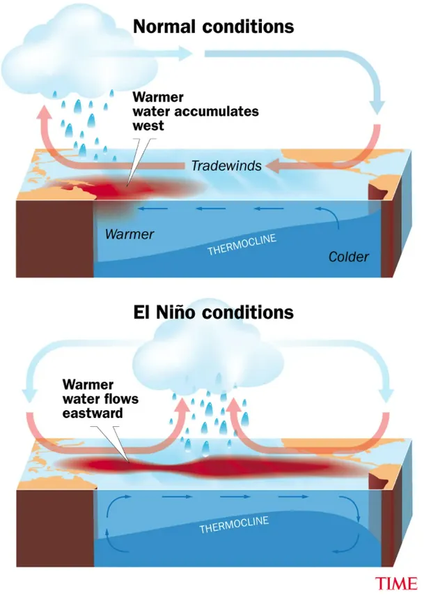
Under normal conditions, trade winds push warm surface water westwards across the tropical Pacific, allowing colder, nutrient-rich water to rise near South America. During El Niño, these winds weaken, allowing warm water to spread eastwards. This disrupts upwelling and shifts atmospheric circulation and rainfall patterns, with consequences for marine ecosystems and weather around the world.
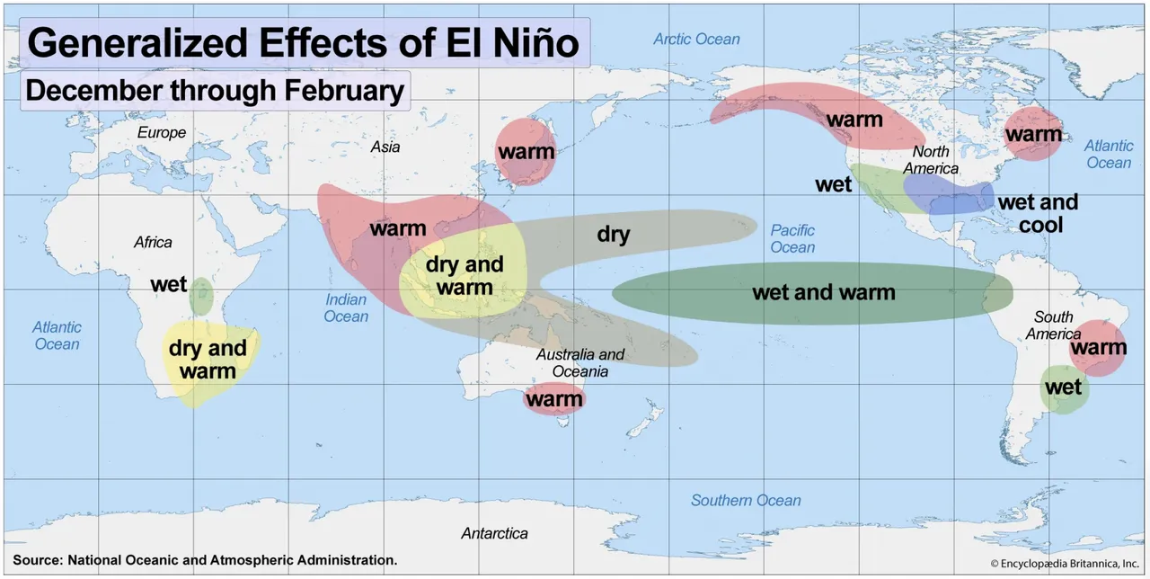
On land, El Niño has interesting effects. As warm water shifts eastwards, rainfall patterns also change, often bringing wetter conditions to parts of South America while contributing to drier conditions in Australia and the western Pacific. These shifts can also influence atmospheric circulation and weather patterns far beyond the tropical Pacific.
El Niño typically starts to develop between March and June, and this year’s event was no different. During the first half of the year, sea surface temperatures across the central and eastern equatorial Pacific began rising rapidly. By mid-August, El Niño was decisively confirmed by the World Meteorological Organization’s (WMO) Global Seasonal Climate Update. In September, the WMO reported that the event was expected to strengthen further and likely persist through February 2027.
How do climate change and El Niño interact?
El Niño is a natural climate phenomenon, while human-induced climate change is driven primarily by greenhouse gas emissions. Although scientists are still investigating how climate change may affect the frequency and intensity of El Niño events, their combined effects are increasingly concerning.
Since the 1800s, human activities, particularly the burning of fossil fuels, have driven climate change by releasing greenhouse gases that trap heat in Earth's atmosphere. This has caused a sustained rise in global temperatures, contributing to melting ice, rising sea levels, and increasingly severe climate-related risks.
El Niño temporarily adds to global warming by releasing heat from the tropical Pacific Ocean into the atmosphere. Against a backdrop of rising temperatures caused by climate change, this additional warming can increase the likelihood of extreme heat and compound existing environmental pressures.
The 2023–2024 El Niño illustrates this relationship. In 2024, global average temperatures reached approximately 1.55°C above pre-industrial levels, making it the hottest year on record. While human-induced climate change was the primary driver, El Niño contributed to the exceptional warmth.
In an ideal world, El Niño events could happen without causing widespread destruction. However, its pairing with climate change – one natural phenomenon, one manmade – can have devastating consequences.
How can El Niño affect ocean inhabitants?
Alongside climate change, intense El Niño events, like the one developing in 2026–2027, can have far-reaching effects on marine ecosystems, disrupting food webs, intensifying ocean warming, and threatening the communities that depend on healthy oceans.
One of El Niño's most significant impacts on marine ecosystems occurs in the eastern tropical Pacific, particularly along the coast of South America. During El Niño events, warmer surface waters reduce the upwelling of cold, nutrient-rich water from the ocean's depths. With fewer nutrients reaching the surface, phytoplankton production can decline. These tiny organisms form the basis of the marine food web, so their decline has serious knock-on effects on countless other marine species. As food becomes scarce, populations of fish, seabirds, and marine mammals can suffer, with consequences for commercial fisheries and coastal communities.
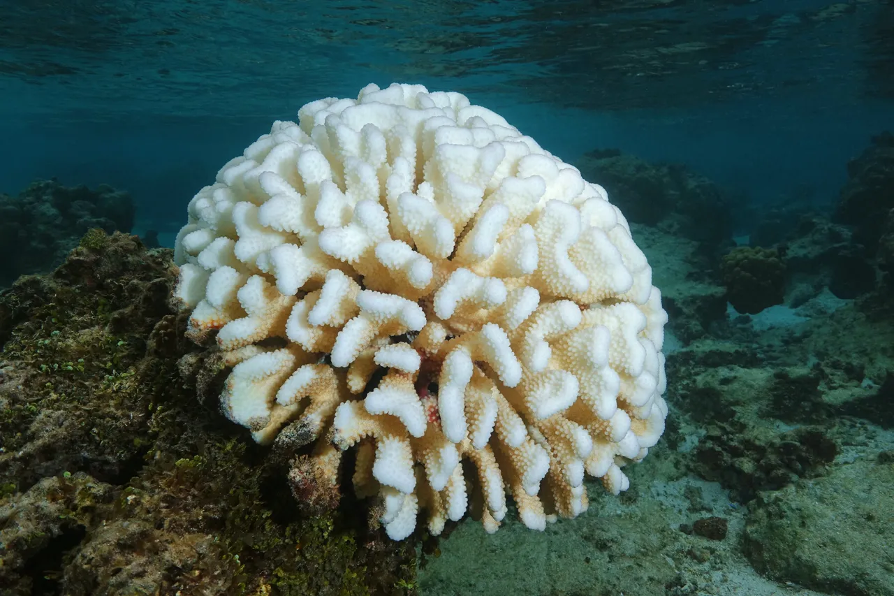
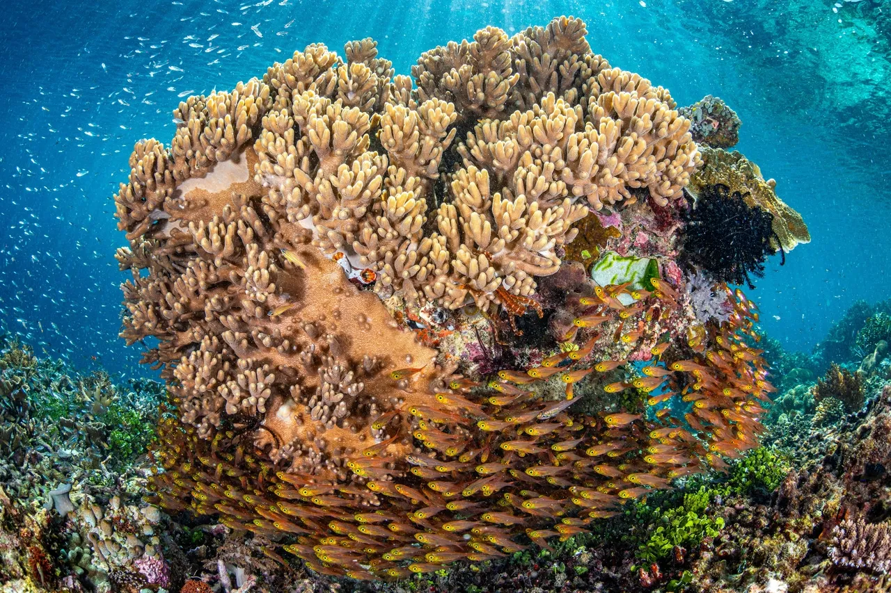
The ocean's increased temperatures can also have devastating effects on coral reefs. Corals are incredibly sensitive to changes in environmental conditions; prolonged heat stress can cause them to expel the symbiotic algae living within their tissues. This is called coral bleaching. Without these algae to provide much of their energy, corals become increasingly vulnerable and may eventually die, threatening entire ecosystems that depend on healthy reefs. El Niño can intensify marine heatwaves in some regions, placing additional pressure on coral reefs already threatened by climate change.
Closer to home, South Africa's Benguela upwelling system is one of the most productive marine ecosystems in the world, supporting an extraordinary diversity of marine life and important fisheries. El Niño can also influence conditions in the Benguela region, but its effects are more complex than those experienced in the eastern tropical Pacific. This is because El Niño can alter wind patterns over the South Atlantic, influencing the upwelling of cold, nutrient-rich water along our coastline. Research suggests that El Niño can weaken upwelling in the southern Benguela while strengthening it further north. However, these effects vary between events, as other climate processes also influence ocean temperatures, nutrient availability, and marine productivity.
El Niño can also influence sea levels, adding to the pressures already facing coastal communities as a result of climate change. A 2026 study published in Communications Earth & Environment found that the rate of sea-level rise around Africa increased by 73% between the periods 1993–2008 and 2009–2024. During the 2023–2024 El Niño, sea levels across African marine regions rose by 2.34 centimetres, accounting for approximately 19% of the total rise recorded since 1993. Researchers found that the event produced exceptional sea-level anomalies, amplified by unusually warm ocean conditions and other climate patterns. These findings highlight how natural climate fluctuations can compound the long-term effects of global warming, increasing the risks of coastal flooding, erosion, and damage to coastal habitats.
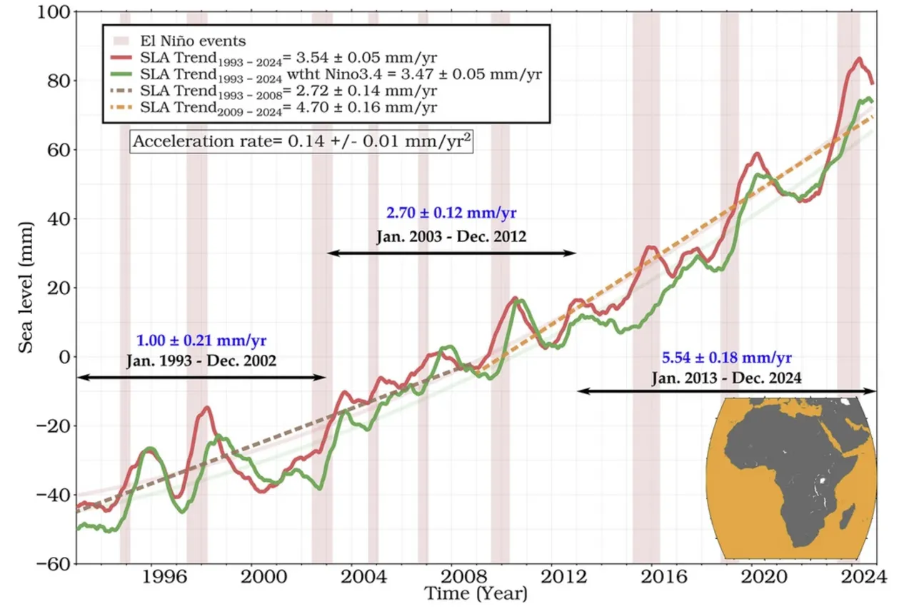
This graph shows how sea levels around Africa have changed between 1993 and 2024, based on satellite measurements. The red line shows recorded sea levels, while the green line shows sea levels with the effects of El Niño and La Niña removed. The pink shaded areas highlight El Niño events. Although sea levels fluctuate naturally from year to year, the overall trend is clear: Sea levels are rising, and the rate of increase has accelerated over the past three decades.
(Graph credit: Communications Earth & Environment)
Ultimately, these impacts demonstrate how El Niño can compound the pressures already facing marine life in a warming world.
What does El Niño mean for South Africa?
In South Africa, El Niño is most strongly associated with hotter, drier conditions across the country's summer rainfall regions, particularly the interior and eastern parts of the country. According to the WMO, the principal threat associated with the 2026–2027 El Niño is below-average rainfall combined with extreme heat from October 2026 to March 2027.
For people, some of El Niño's most significant impacts are felt through agriculture, health, and water security. Below-average rainfall can reduce soil moisture, river flows, and reservoir levels, increasing the likelihood of drought. Combined with higher temperatures, these conditions place additional pressure on water supplies and food security while heightening the risk of wildfires. These impacts can be particularly severe in developing countries, where livelihoods are often dependent on natural resources and access to adequate housing, healthcare, and sanitation may be limited.
Although El Niño's influence on rainfall is less direct in the Western Cape, where most rain falls during winter, the province still faces potential risks. Indeed, the SAWS has warned of lower-than-average rainfall for the Western Cape, meaning there is a high risk of extreme heat, increased fire danger, and additional strain on water resources.
How is South Africa preparing for El Niño?
Government representatives have stressed that preparedness for El Niño cannot begin when the first wildfire breaks out, when water systems come under pressure, or when a prolonged heatwave starts affecting vulnerable people. Rather, preparations should be made far in advance.
Thankfully, improvements in seasonal forecast models now allow climatologists to anticipate broad climate patterns several months in advance. By identifying potential rainfall deficits and drought trends, this information provides early warnings to support planning in climate-sensitive sectors like health and agriculture, as well as the implementation of government emergency protocols.
In September 2026, the South African government confirmed that an interdepartmental team was working on a coordinated response to the anticipated impacts of El Niño, focusing on water security, agriculture, food security, and public health. In the Western Cape, the provincial government has allocated more than R65 million towards strengthening municipal water infrastructure, improving resource management, and developing alternative water supplies.
On a regional scale, the Southern African Development Community (SADC) held a four-day Disaster Preparedness and Response Planning Workshop in October 2026 to assess potential risks, improve contingency planning, and ensure that early warnings translate into timely action. Drawing on lessons from the 2023–2024 El Niño event, the workshop highlighted the importance of coordinated responses and early intervention.
How can we prepare for El Niño?
While government planning and investment are essential, individuals and communities also have an important role to play in preparing for a hotter, drier summer. Every small, everyday action can have a meaningful impact when we all do our part.
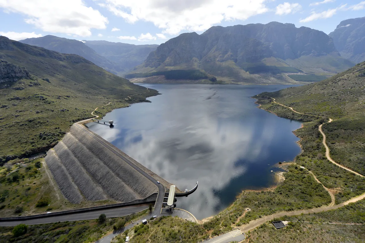
According to the City of Cape Town's November 2026 figures, dam levels stood at 71.7%, while daily water consumption had recently reached 912 million litres, exceeding the City's target of 860 million litres per day.
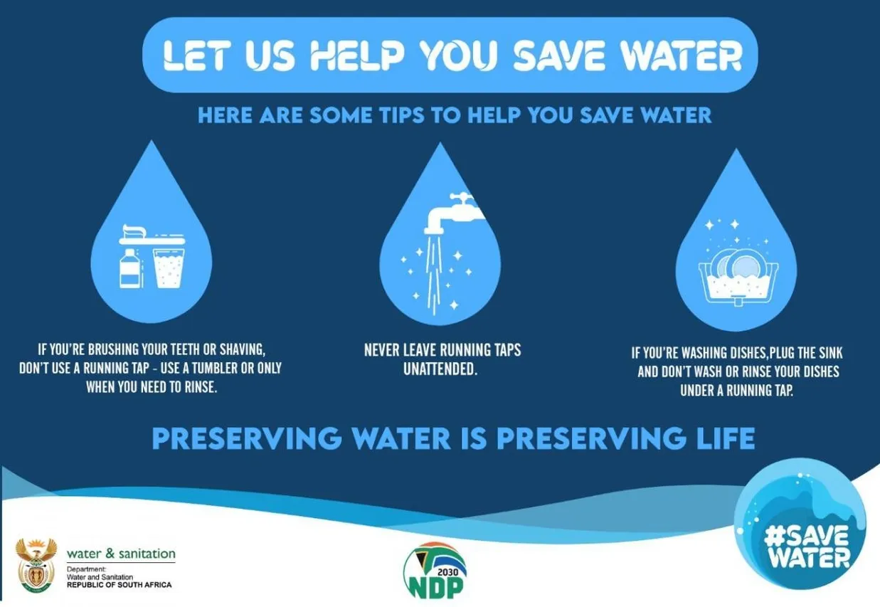
Every drop counts when it comes to protecting our precious water resources. Simple changes, like taking shorter showers, running washing machines and dishwashers only with full loads, and being mindful of unnecessary water use, can collectively make a real difference. Beyond saving water, South Africans can also keep an eye on SAWS weather warnings, take precautions during heatwaves, and practise fire safety, particularly in fire-prone areas.
By looking out for our environment and one another, we can help build more resilient communities, one small action at a time.
El Niño is a powerful reminder of how closely connected our ocean, atmosphere, and lives really are. Although we cannot prevent this natural climate phenomenon, understanding its effects and preparing for its impacts can help protect vulnerable communities and ecosystems. As our planet continues to warm, scientific research, early action, and a shared commitment to protecting our environment are more important than ever.
Related News

Sign up to our Newsletter
Receive monthly news, online courses and conservation programmes.