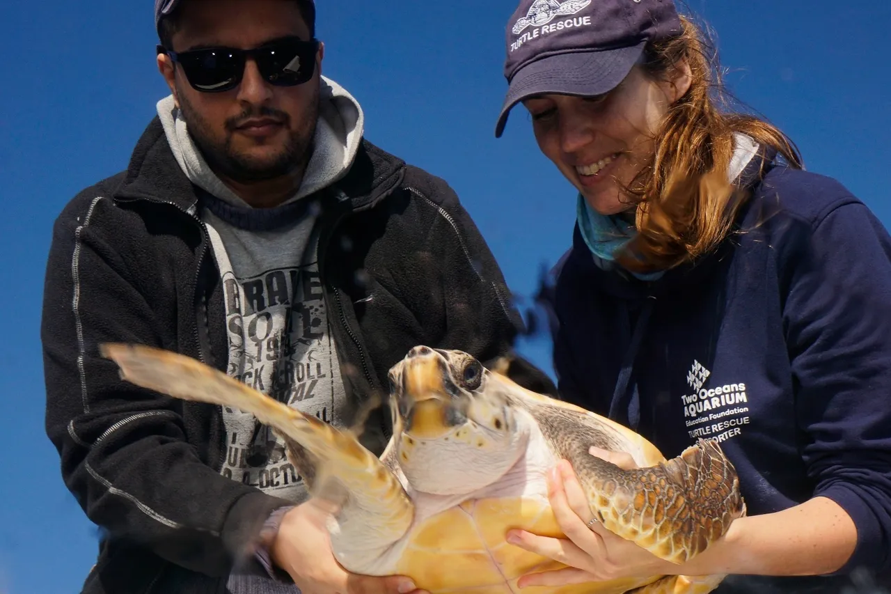
Tracking our Turtles: Moving into May
Are you ready for another turtle-y fascinating glimpse into the movements of our Turtle Conservation Centre’s satellite-tagged turtles? Bheni, Nobomvu, Turbo, and Pan have been making incredible progress across the ocean – each of their journeys a testimony of the power of rehabilitation and a contribution to global turtle research.
Let’s hear more from Talitha Noble-Trull, Conservation Manager at the Turtle Conservation Centre.
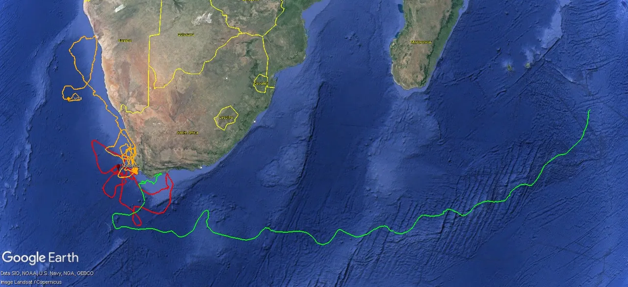
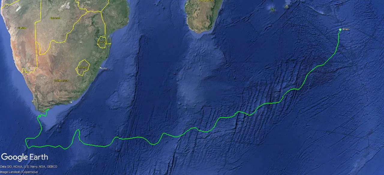
Bheni, the green turtle
Bheni, our travelling green turtle, has been in the ocean for 150 days! After about a year of rehabilitation, Bheni was released within the boundaries of the De Hoop marine protected area (MPA) in December 2023. He took a week to find his flippers within the safety of this beautiful, biodiverse reserve. Then, he joined the retroflecting, warm Agulhas Current and headed east.
Bheni spent nearly two months in the Agulhas Current, utilising its speed to gain significant distance into the Indian Ocean. In early March, Bheni began to deviate from this current, turning in a North-easterly direction. If you look at the topography (landscape) of the ocean floor, it is quite clear that Bheni was following the line of the Southwest Indian Ridge!
Ridge lines are like underwater mountain ranges and are generally areas of greater ocean productivity. This is because of a process called upwelling: Nutrient-rich water from the deep, cold ecosystems at the “foothills” of the ridge lines is pushed up into the warmer surface water, fertilising these waters and making them a haven for turtle food sources. Hopefully, Bheni was snacking substantially as he was swimming!
Currently, Bheni is 900km east of Mauritius – this is a seriously tropical territory with a water temperature of 27°C! To date, Bheni has travelled an impressive 8 080km. This averages 53.8km per day, which is the same daily distance he was covering a month ago.
It is remarkable to witness Bheni’s movements as he maintains his speed and covers great distances. This prompts the question: Does he have a destination in mind or is he just enjoying his freedom?
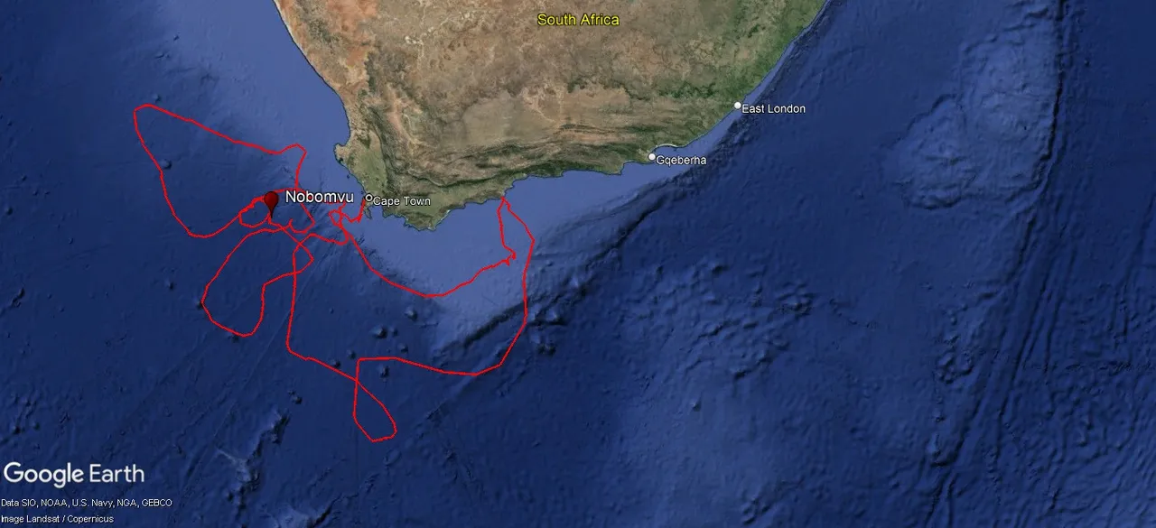
Nobomvu, the loggerhead turtle
Our Red Lady, Nobomvu, has been taking it easy since the Turtle Conservation Centre last checked in with her a month ago. She has been following the surface currents just off the south-eastern side of the African continental shelf. These surface currents, with their steady flow. allow Nobomvu to save her energy by simply moving in the direction of the water. Nobomvu is currently about 200km west of Cape Town in water which is 20°C!
At her current position, maps indicate that there are high levels of phytoplankton. This implies that the ocean productivity in this area is relatively high – jellyfish and all kinds of other yummy turtle food sources eat phytoplankton. This means that Nobomvu is probably enjoying increased food availability!
To date, Nobomvu has travelled 5 700 km, averaging 39 km per day. It will be interesting to see where she ventures next – will she continue exploring the biodiversity of the continental shelf or head out into the open ocean?
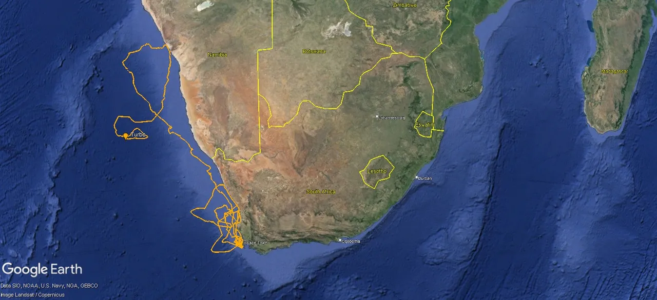
Turbo, the green turtle
In the last month, green turtle Turbo has slowly been moving southward again. At times, he has spent time closer to the coast, where waters are warmer and abundant in foraging grounds, before moving further offshore. Currently, Turbo is 500km west of Luderitz in Namibia!
The Turtle Conservation Centre has been tracking Turbo for 500 days now. It has been incredible to see how he has followed the western coastline of southern Africa. As we have witnessed for several of our other satellite-tagged turtles, it is clear that this western coastline is an important one for turtles – Turbo is adding to the database of research that we are gathering on the behaviour of subadult turtles in the area.
To date, Turbo has travelled 8 400 km, averaging about 17 km per day.
Pan, the loggerhead turtle
After 631 days of tracking, our Turtle Conservation Centre has lost contact with Pan, the loggerhead turtle. This is because the satellite tag has either fallen off due to the shedding of Pan’s growing carapace (top shell) or the battery has run out.
We are incredibly grateful for the opportunity we had to monitor Pan as he travelled the ocean – becoming our “Namibian explorer”. Watch this space for a special update all about our journey with Pan, from being the littlest loggerhead turtle in the I&J Ocean Exhibit to his emotional release into the ocean!
What is the impact and purpose of satellite tags?
Satellite tags are radio transmitters that are attached to the turtle’s carapace, or top shell. These tags emit signals that are detected at certain time intervals by satellites orbiting the Earth. Locations with varying accuracy can be assigned, depending on the signals received from individual tags. Satellite tags can provide GPS coordinates, dive time, depth, swimming speed, and even water temperature. This information can be used to plot the turtle’s path around the world. Even if the turtle swims thousands of kilometres from its release site, satellite technology can track it!
Tagging is instrumental in our understanding of turtle lifestyles and can play a crucial role in conservation efforts. Turtles spend most of their lives at sea, making them difficult for researchers to study consistently. The knowledge provided by tagging data is a window into the elusive world of turtles, giving insight into how we, as humans, can help conserve turtle populations.
Related News
Sign up to our Newsletter
Receive monthly news, online courses and conservation programmes.